
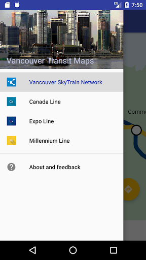
Features Trainsity Vancouver SkyTrain
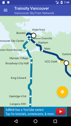
Find your way around Vancouver city using the high resolution vector maps of the SkyTrain train network.
The maps have small file size footprints but with many levels of zoom and can work offline without connecting to the Internet.
Users can click the train station labels to open Google Maps or Google StreetView, where they can use all the functions of the Google apps to visualize the surrounding area and/or perform routing for directions.
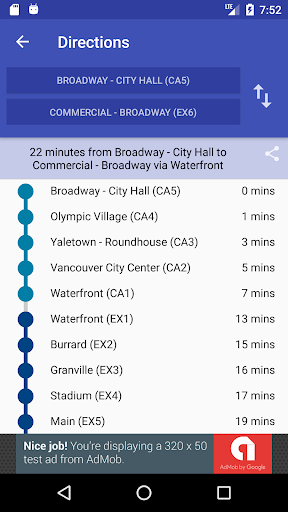
There is also an offline function to calculate the best way to travel from a station to another station with a direction breakdown and timings (which may vary from the actual traveling time).
* Now with dark mode setting.Important Notice: This App will be deprecated soon and unpublished from the Play storeWe want to inform you that this app will soon be deprecated and will no longer receive updates or support.
But don’t worry!
We’ve launched a new and improved app, Trainsity, designed to offer an even better experience for finding the shortest paths and navigating transit systems.To continue enjoying seamless transit navigation, please download our new app from the Google Play Store: https://play.google.com/store/apps/details?id=com.dom925.trainsityThank you for your continued support!* Now with dark mode setting.Photo credit: http://commons.wikimedia.org/wiki/File:Lions_Gate_Bridge_at_night.jpg
Social Features
Connect and share with friends and the community.
Gaming Features
Enjoy immersive gaming experience with various game modes.
Camera Features
Advanced camera features with editing capabilities.
See the Trainsity Vancouver SkyTrain in Action
Get the App Today
Available for Android 8.0 and above